
:
Exploring Old Telegraph Track North, Cape York Qld
The northern section of the Old Telegraph Track, which runs from Bamaga Road to the Jardine River Ferry, is perhaps the quintessential Cape York 4WD experience.
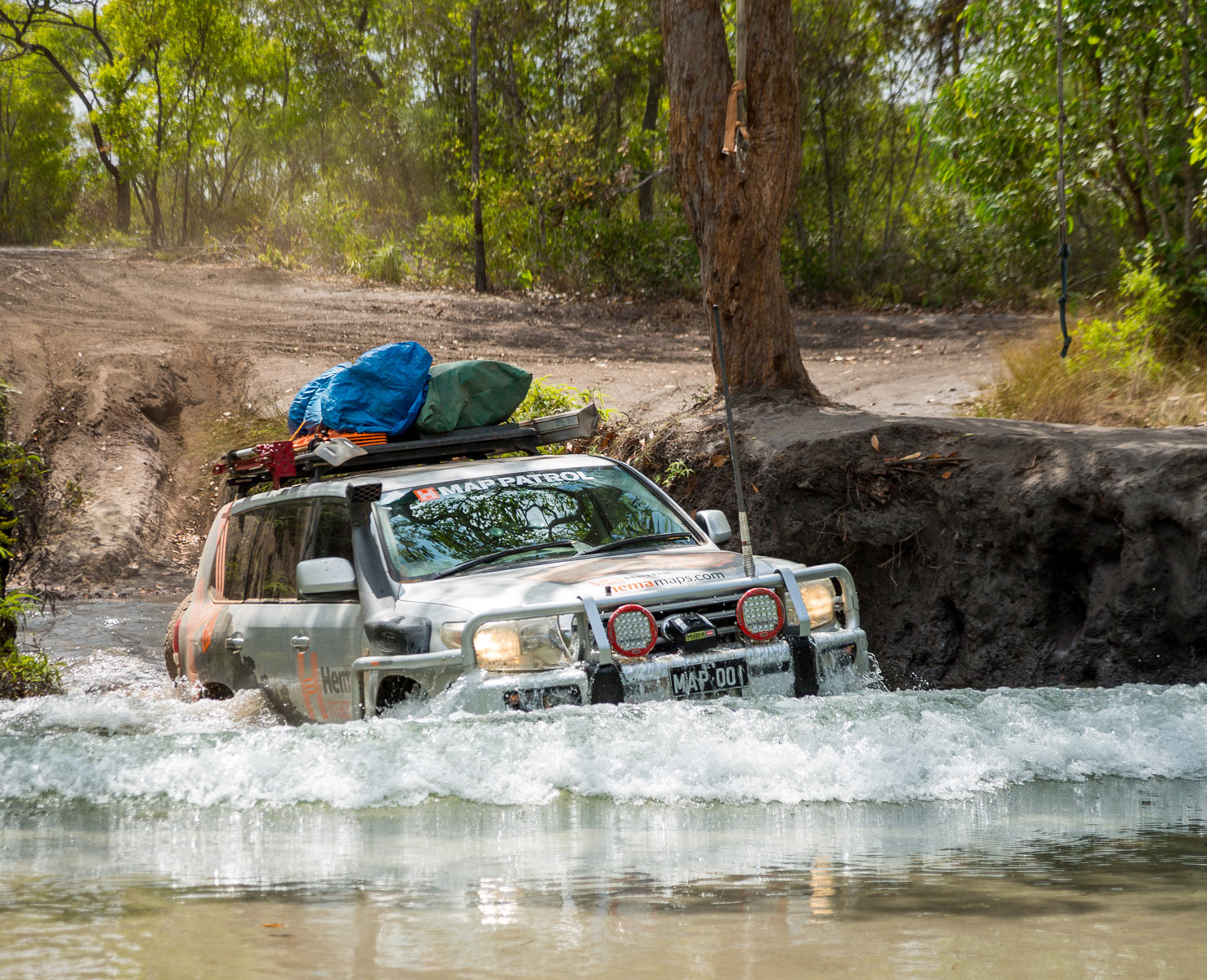
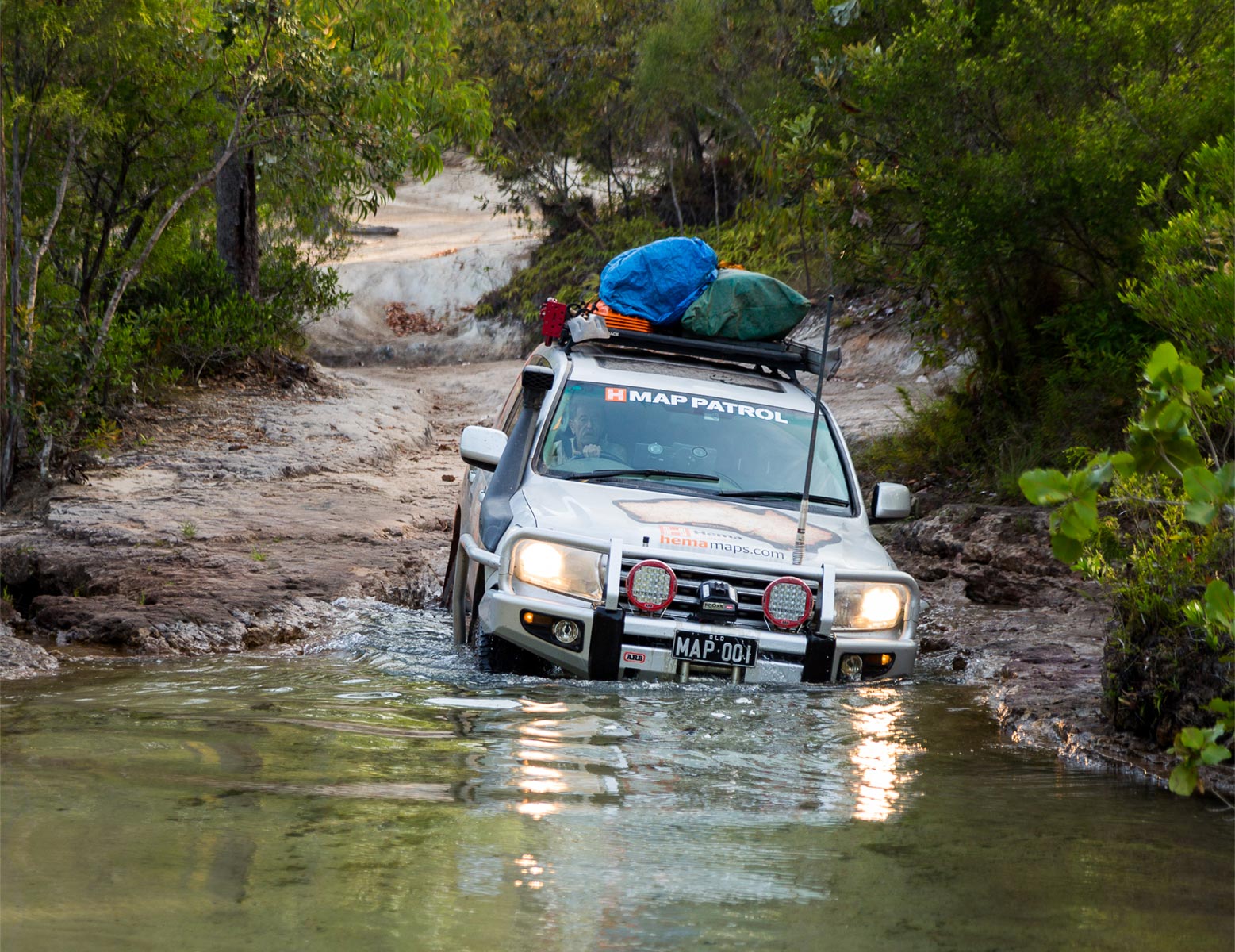
Bridge Creek Ford
To help you navigate this rugged and remote part of Australia the Cape York 4WD Pack, Cape York Atlas & Guide and a trusty Hema HX-2+ Navigator should be part of your kit before you leave home.
Grading: Difficult – low range gearing and high ground clearance: take traction aids and recovery gear.
Time: Day trip or overnight
Distance: 82km, Bamaga Rd to Jardine River Ferry
Longest drive without fuel: 201km, Bramwell Junction to Jardine River Ferry via Bamaga Rd and Old Telegraph Track
Best time of year: Dry Season (May – October).
Warnings: Deep creek crossings and very steep and slippery river banks.
Permits and fees: Camping in Jardine River National Park at the Jardine River and Eliot Falls sites requires a permit. Campers must buy an e-permit before arriving: book online at qpws.usedirect.com/qpws/ or phone 13 QGOV (13 74 68)
Facilities: Bramwell Junction, Jardine River Ferry
Camping: Bush camping at Canal Creek, Sam Creek, Mistake Creek, Cannibal Creek, Cypress Creek and Bridge Creek (Nolan's Brook), Jardine River National Park, Jardine River (Southern side), Eliot Falls
Important contacts: Bramwell Junction Ph (07) 4060 3230, Jardine River Ferry Ph (07) 4069 1369, Heathlands Ranger Station Ph (07) 4060 3241
The Track
While it is entirely possible to drive the Old Telegraph Track from north to south, it is not advised, as the majority of traffic travels south to north, and there are few passing opportunities.
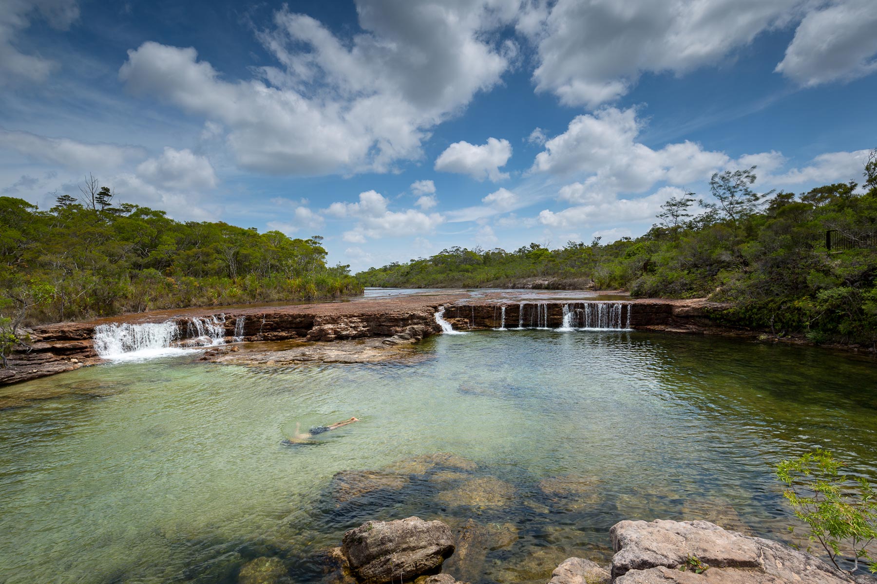
Fruit Bat Falls
From the Bamaga Road there’s a turnoff on the right to the Old Telegraph Track. There’s a fork to the right for access to Fruit Bat Falls: a great swimming spot affording day access only to the wide blue-green pool and cascade. From here the track runs straight until the turnoff for Eliot/Twin/ Indian Head Falls just before Canal Creek. The Falls are one of the best swimming and photography spots on the OTT. There are several falls and swimming areas here, with plenty of camping and toilets.
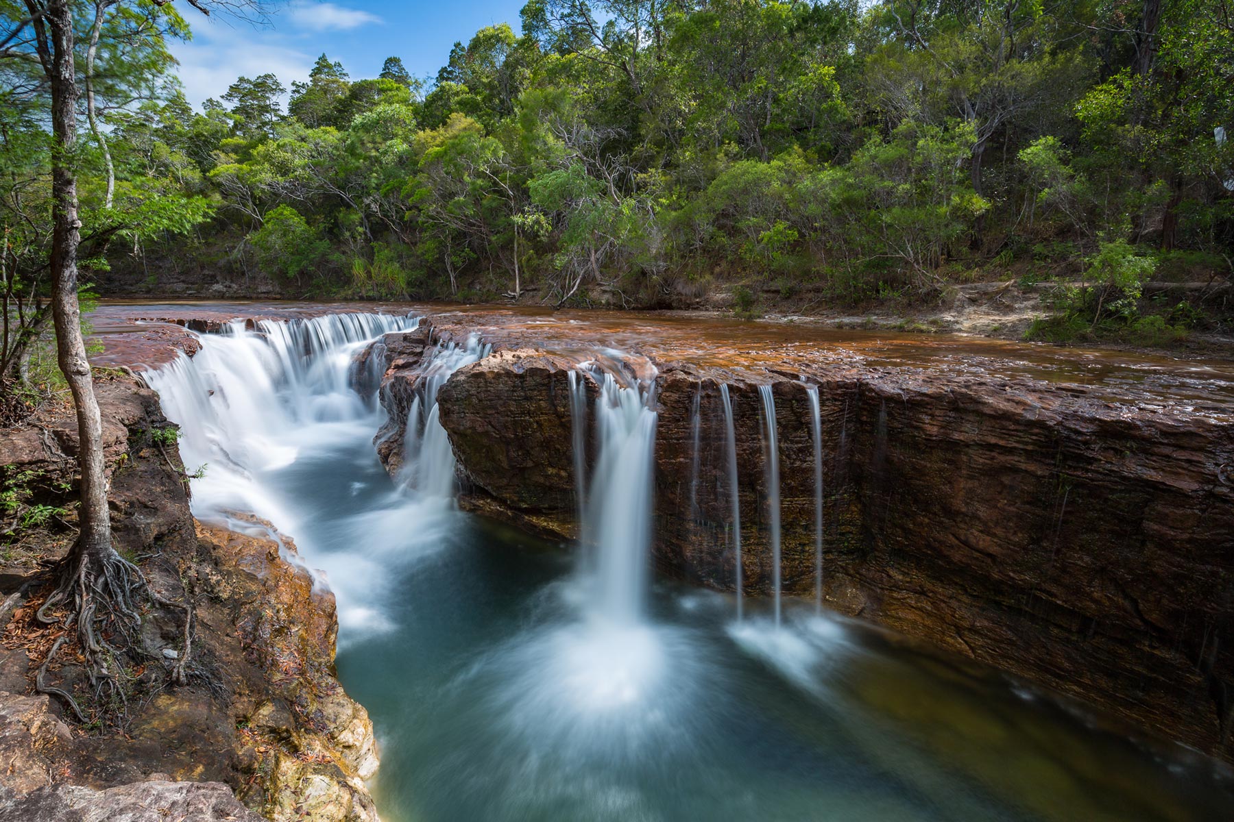
Eliot Falls
Canal Creek is a deep blue-water crossing with a winding left-hand exit to avoid the washed out gullies of the old exit to the right. There is room to camp here, away from the crowds of Eliot Falls, but close enough to drive out for a swim.
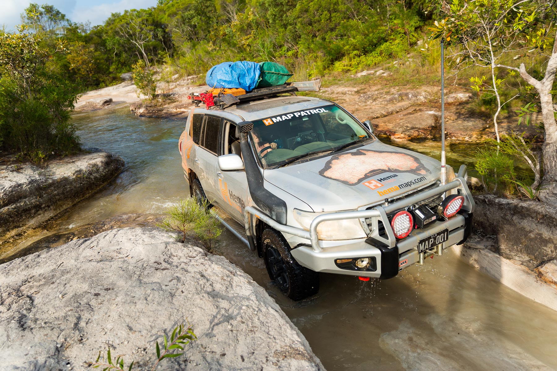
Canal Creek
Sam Creek has great camping and excellent clear water swimming holes downstream from the easy crossing.
Sam Creek
Mistake Creek has a steep, eroded entry, but is straightforward from the bottom. Cannibal Creek is an easy crossing with camping, and Cypress Creek is crossed via a rickety old log bridge that has seen better days, but still seems to be doing the job.
From here there is a long drive before what has become the biggest obstacle south of the Jardine River: Nolan’s Brook, or Bridge Creek. The bridge long ago fell apart, and with up to 1.5m of water and a soft sandy bottom, the right line can mean the difference between making it and not. The hard right line is usually shallower with a firmer bottom.
The track continues north to the old Jardine River ford, with great camping in open grassland, or there is a turnoff to the Bamaga Road to catch the Jardine River Ferry.
Things to do
A common and worthwhile diversion during any point of this drive is helping out fellow travellers who are bogged or waterlogged. The opportunity to help someone out should be embraced: after all, 10 minutes of your time could mean the difference between a bit of water in the floorboads or the end of their trip of a lifetime.
Crossing the Jardine River
Until the Jardine River Ferry was instituted, vehicles had to drive across this fast-flowing 140m wide saltwater crocodile-infested river. These days, a few crazy travellers still wade across the metre-plus deep water and attempt the crossing. However, the Injinoo Aboriginal community have requested that travellers do not cross, as a man was killed by a crocodile in 1993 swimming out to the ferry with a replacement part.
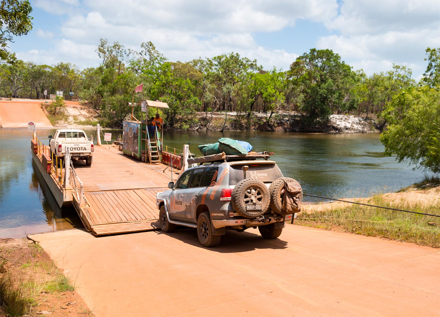
Jardine River Ferry crossing
For the 2024 season the ferry price is $130 for a single vehicle ($205 with a trailer) and $60 for a motorbike.
You can book your ferry pass and a spot at the Jardine River Ferry campground via the Northern Peninsula Area Regional Council website
Next steps
At Hema Maps, we strive to provide the most comprehensive and accurate maps and guides for outdoor enthusiasts looking to explore Australia's natural wonders.
Did you find this information useful? If so, please share it with your fellow explorers. Whether it's by SMS, social media, or email, your friends and fellow adventurers will appreciate the valuable tips and insights we've shared.
Let's work together to make the most of every adventure.


0 comments