
:
Top 5 4WD Tracks in WA
Western Australia is a four-wheel driver’s paradise with its vast open spaces and unique landscapes offering a myriad of tracks to challenge the hardiest of adventurers. Here is Hema Maps’ top five tracks to help you plan your next offroad trek.
1. Anne Beadell Track
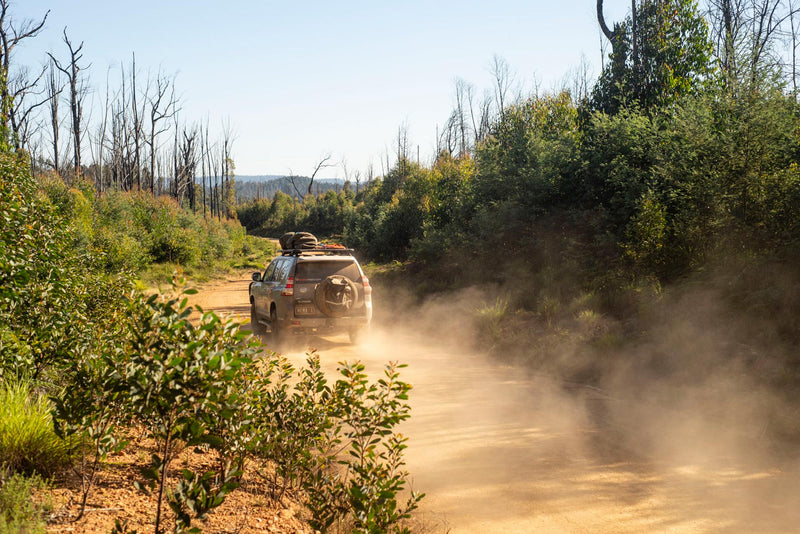
When it comes to remote outback travel, few tracks compare to the Anne Beadell Highway. Named after the wife of Len Beadell, this track runs from Laverton WA to Coober Pedy SA, covering some 1380km and passes through the Great Victoria Desert, Australia’s largest dune desert. 
This is an extremely remote track. Unless you are an experienced desert traveller, solo travel is not recommended. The track is graded as medium and will take about one week. The longest distance without fuel is 818km from the Ilkurlka Roadhouse – where there is fuel and other supplies – to Coober Pedy.
Prepare your vehicle well, carry all necessary fuel and water, take the right communications (a satellite phone is recommended), take more than adequate food and water, carry a sensible range of vehicle spares, including two spare wheels and tyres, and tyre repair equipment such as a Tyre Plier kit.
Put a red flag on your aerial and use your UHF to alert other travellers of your presence. An EPIRB (emergency position indicating radio beacon) is useful if there is an extreme emergency.
Avoid travelling the Anne Beadell Highway in the summer months as temperatures are extremely high. The best time to travel is May to September but remember that night temperatures can drop below freezing.
Things to Do
The western end of the Anne Beadell Highway begins at the historic gold-mining town of Laverton. Before you head off, visit the Laverton Great Beyond Explorer’s Hall of Fame.
Yeo Lake Nature Reserve embraces the geologically and ecologically significant Yeo Lakes system together with remnants of what were large stands of sandalwood. Point Sunday was named by Len Beadell, and marks one of his construction camps. The mesa summit at Point Sunday provides extensive views across the landscape and is well worth the walk.

Yeo Lake Homestead (Credit: Matt Williams)
The Connie Sue Highway (see Hema Maps’ Great Desert Tracks Atlas & Guide) crosses the Anne Beadell at Neale Junction. A light aircraft wreck of a Goldfields Air Services flight that crashed in 1993 is located to the north of the Anne Beadell, 59km west of Ilkurlka.
Ilkurlka Roadhouse has some excellent cultural and environmental displays and lies at the heart of the local Tjuntjuntjara country. The Roadhouse provides fuel and camping facilities, including showers, and sells cultural artefacts. The tracks to the north and south are not accessible to the public.
The Serpentine Lakes, a long series of salt-encrusted lakes, marks an ancient drainage basin that ran down to the Great Australian Bight. The WA/SA border is crossed on the western side of these lakes, where you’ll find a tank and picnic shelter. A track to the south of these amenities leads to a large rock or gnamma hole named Djindugara. Len Beadell’s grandson Mitchell was christened at this spot in July 1992.
East of the Serpentine Lakes the gibber plains give way to sandy desert with dunes becoming more numerous and higher. In this region you pass through beautiful stands of black desert oak. About 49km from Voakes Hill Corner you crest a rise (350m) in a dissected upland which affords expansive views to the east across what appears to be an endless woodland of oak and shrubs. At Voakes Hill Corner a track south heads to Cook on the Trans-Australian Railway.
East of this corner, the track enters some of the most beautiful sections of the Great Victoria Desert, both in terms of dune formations and vegetation.
At Anne’s Corner, Mount Davies Road – which enters Pitjantjatjara Lands to travel north to Kunatjara, Pipalyatjara and Mount Davies – is closed to the public. The southern section was constructed by Len Beadell’s party in June and July of 1957 and was regarded by Beadell as the most difficult track he constructed. A short walk up this track will reveal just how spectacular this desert dune region is.
West of Emu is a turnoff north to Emu Claypan – named for the footprints found on its surface. English scientists associated with the atomic testing in the area asked Len what the prints were. “Emus,” replied Len and the term stuck. The claypan became a busy airstrip with equipment and personnel being transported by the snub-nosed Bristol Freighters and large York planes.
The Emu atomic bomb testing sites can be visited with safety. Sites include Totem 1 and Totem 2; two locations where bombs tested on detonation towers that are now marked by concrete obelisks. At the obelisks you can see samples of stone turned into ‘glass’ by the heat of the blasts. One of the eerie reminders of the detonations of October 1953 is the change in vegetation pattern and structure when approaching Emu from either direction. Trees and woodland give way to low scrubland, delineating the extent of the fire-zone.
Access is no longer permitted south of the Anne Beadell Highway to Observatory Hill – where the blast was planned, controlled and viewed. Anyone wishing to visit Maralinga can travel under the permit system along the Anne Beadell Highway to Voakes Hill, south to Cross Road and east to Maralinga Village. From Maralinga it is possible to continue south via Ooldea to Colona on the Eyre Highway. (Permits are available from reception@maralinga.com.au or by calling the Maralinga Ceduna office on (08) 8625 2946.)
East of Emu, the Anne Beadell passes over the low hills and rises of an undulating plain covered by grass and shrubs. The swales between dunes are broad and crossings are made at an angle. About 53km west of the Dog Fence (the longest fence in the world), Tallaringa Well is located just south off the track.
Coober Pedy is often referred to as Australia’s opal mining capital and it is the eastern ‘jumping off’ point for the Anne Beadell Highway.
Maps:
Hema Maps’ Great Desert Tracks Central.
Permits and Fees
A transit permit is required for the Yamarna to Neale Junction section from the Department of Planning, Lands and Heritage (DPLH) – formerly Department of Aboriginal Affairs (DAA). Permits are free and available here.
You’ll also need a permit from Maralinga Tjarutja Incorporated. An application form is available online but allow four to six weeks for processing. For more information visit the Maralinga Tjarutja website.
A Tourist Permit is required to access any part of the Woomera Prohibited Area (WPA) except the Stuart Highway, Lake Cadibarrawirracanna Road (Public Access Route), Olympic Way – Pimba Road (B97), William Creek Road and Woomera Village. For more information about tourist permits are available here.
You don’t need a Desert Parks Pass to camp in Mamungari (Unnamed) Conservation Park, but you’ll need a camping permit. A Desert Parks Pass and camping permit are required for Tallaringa Conservation Park.
 Spinifex throughout Mamungari Conservation park (Credit: Matt Williams)
It is an offence to possess liquor in the Spinifex Native Title Determination Area,
however some exceptions apply for tourists. It is possible for tourists to travel through the area if they don’t consume the liquor until they leave the restricted area. Consumption of liquor is permitted if you are within 50m either side of the Anne Beadell Highway (also known as the Serpentine Lakes Road). For more information about the restrictions, go here.
Contact Details:
- Coober Pedy Visitor Centre
- Ilkurlka Roadhouse
- Tjuntjuntjara Community
- The Great Beyond Visitor Centre
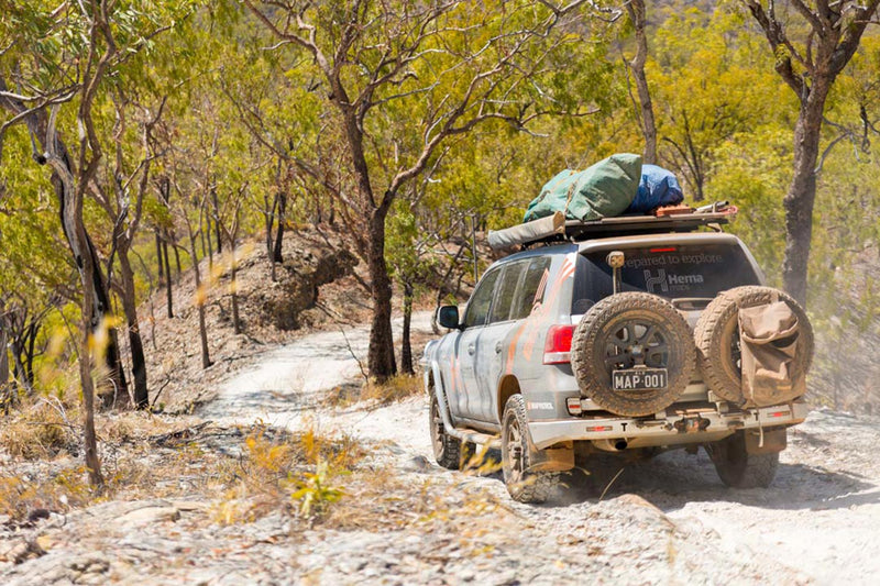
2. Canning Stock Route Track
Without a doubt, the Canning Stock Route (CSR) is the most demanding 4WD track this country has to offer. It isn’t just the demand on the vehicle either. A great deal of physical endurance is also required. There are a lot of kilometres between Wiluna and Billiluna – and even more corrugations.
Following the route blazed by Alfred Canning back around 1906, this track covers almost 1600 kilometres of pure offroad heaven. There’s a lot of history thrown in for good measure, as you wind your way past the sites of 51 wells.
This trip requires in-depth research and careful planning. You must be self-sufficient with all emergency equipment and ensure your vehicle is in good condition. Take plenty of water. Unless you are extremely self-reliant, this is not a trip to be attempted solo, rather with a few highly experienced four-wheel driving friends or as part of a Tag-Along tour.

Although many camper trailers are capable of travelling this route, towing is not recommended because of the damage being caused to the track. Camper trailers are not permitted on the Cunyu Station section of the CSR between Well 3A and Windich Springs. In sand dune country, vehicles should fly a sand flag to warn oncoming vehicles. Due to cultural reasons and environmental degradation camping is now discouraged at some wells in addition to Windich Springs and Breaden Pool. Do not park cars at Well 38 as the site is soft and susceptible to caving in.
CSR will take two to three weeks to complete, and the longest distance without fuel is 963km – Wiluna to Kunawarritji – unless you’ve organised a fuel drop at Well 23. The best time of the year to travel this route is May to September. Winter nights can drop below zero and summer can be dangerously hot.

Things to Do
Any travellers with a passion for Australian outback history will enjoy the sense of stepping back in time as they travel a route once trodden by cattle, horses and stockmen all those years ago. There is plenty to keep you busy along the CSR, with grave sites at a number of the wells. Just a short walk from Well 40, you can find the grave of Michael Tobin. Tobin was a member of Canning’s original party and in 1907, on their return to Wiluna, he was fatally speared. At the same moment, Tobin shot and killed Mungkututu, the Aboriginal man who had speared him. Close by, there is a grave for Mungkututu marked with white rocks. At Well 37, also known as the ‘Haunted Well’ due to the collection of grave sites, you will find the graves of drovers Christopher Shoesmith, James Thompson and an Aboriginal stockman known as Chinaman.
Alfred Canning’s wells dot the track, emphasising the CSR’s original purpose. Most are dilapidated, but several have been restored by various volunteer groups, giving visitors a clear impression of what the original CSR looked like. Whether they are operational or not, these wells make fascinating viewing, especially when you consider the history behind them.
The landscape along the route is always changing as it passes through four different desert regions – Tanami, the south and north Gibson, and Little Sandy Desert. Sometimes it seems to change from dune to dune, especially after winter rains when the wildflowers are in bloom. The scenery is typically desert landscapes, but there are gorges, ranges, gum-lined riverbeds and tranquil camping sites along the way. Camping in the desert is an unforgettable experience as it is hard to believe how many stars are visible in the night skies.

Water from Wells
As this is at least a two-week trip, it’s near impossible to carry enough water for desert conditions. Therefore, you are reliant on the wells built by Canning.
In order to get water out of the wells, you will need a sturdy bucket with a handle and a long strong rope.
Your vehicle should have the capacity to carry at least 100L of water and your supplies must last until the next good well at least. Boil water before use.
Maps:
Hema Maps’ Great Desert Tracks West.
Permits and Fees
Two permits are currently required for the CSR, and neither is available through the Aboriginal Lands Trust. If you wish to travel the full length of the CSR you will need both permits.
One permit covers the sections between Wells 5-15 and 40-51 and is available online through the Kuju Wangka website. For a non-commercial (private) light vehicle the permit is $50. There is an additional $25 fee for trailers, but these are not recommended on the CSR. A CSR information booklet is available for $16.50, or you can download a free digital version once you have paid for your permit.
The permit for the section between Wells 16-39 is available online from the Australian National Four-Wheel Drive Council. The fee for this section is $100 for individual travellers.
Access is currently closed to the Katjarra (Carnarvon Ranges) area, but the Traditional Owners continue to work to secure a business model that can support opening in future years.
Even with a permit, access restrictions still apply to other areas including the Calvert Ranges, Durba Hills, Percival Lakes and Puntawarri Track.
Fees apply to access the CSR through either Granite Peak or Glenayle stations.
An online permit system is now available for travellers wishing to visit and/or camp in the Paruku IPA (Lake Gregory), Lake Stretch and Sturt Creek areas. Permit fees are $10 for a day trip visitor or $30 for the first night camping with additional nights charged at $10 even if you change campgrounds.

Contact Details:
- Australian National Four-Wheel Drive Council
- Glenayle Station
- Granite Peak Station
- Halls Creek Travel and Tourism
- Kuju Wangka
- Paruku IPA
- Wiluna Shire Office
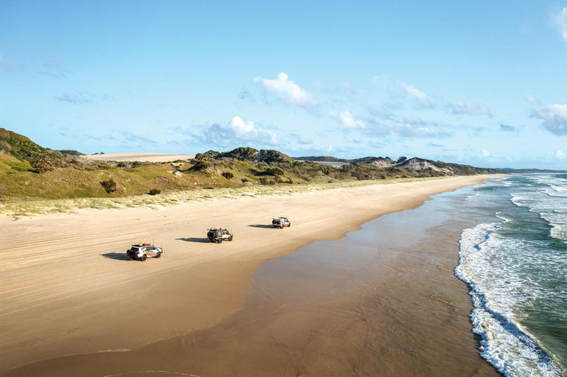
3. D'Entrecasteaux National Park – Warren track
Graded as difficult, this 106km trek starts and ends in Pemberton and is best done with other experienced four-wheel drivers if you’re planning to do Callcup Hill and the Warren Beach drive.
Crossing the Warren River mouth can be treacherous for most of the year, so always seek the ranger’s advice for the latest conditions. If you have any doubts, don’t do it.
High clearance is required to tackle the optional Callcup Hill and Warren Beach drive sections. Always lower tyre pressures if you are doing the dunes.

In the Yeagarup Dunes D'Entrecasteaux, National Park WA
Any time, although spring is best for wildflowers. Winter can be very wet and windy, and the Warren River mouth is often impassable in these months.
From Pemberton head out of town on the Vasse Highway then go south along the Pemberton-Northcliffe Road, passing the turn-off to Old Vasse Road. Cross the Warren River at 9km then pass Callcup Road, staying on the main road for another 2km to Allis Road.
After 2km on Allis Road, veer left onto Malimup Track and then turn right onto Plantation Road.
The next few kilometres involve veering left at two forks and crossing two bridges. A right turn into Lewis Road at 22km is signposted to the Warren River. The track becomes 4WD as you veer left at 28km, and you should lower your tyre pressures at this point.

Warren River
It is 7km to the Callcup Hill ‘car park’. Have a look at the ‘hill’ before making your decision about whether you’ll go down to the beach or not. Even if you aren’t attempting the Warren River beach crossing, you need to be confident you can get back up the soft steep dunes of Callcup Hill if you go down to the beach at all.
If the conditions are right, it is possible to turn right on the beach and cross the Warren River to gain access to Yeagarup Dunes. If you are going that way, make absolutely sure you can safely cross the river – January and February are when it may be crossable. If the river has broken through, it flows fast and can be deep so crossing it is not endorsed by the DBCA (Department of Biodiversity, Conservation and Attractions). Many rigs have been rescued after trying to complete this crossing.

Warren Beach Crossing
If you are not taking on Callcup Hill, head back 22km to Barker Road where you turn west. Follow the forest track to Ritter Road where you turn south towards Yeagarup Lake. It is 2km to Yeagarup Lake which is a lovely place for a spot of kayaking. There are campsites, plus an area to let the tyres down. The Yeagarup Dunes are just over the hill, and if you feel like a bit of a play you can follow the white trail-markers and then the trail down to the beach. To avoid getting bogged, and causing environmental damage, try not to veer away from the markers. Once you’ve had a little fun on the beach just return the way you came.
Back at the junction north of Yeagarup Lake continue along Ritter Road to the gravel Old Vasse Road. After 4km turn off onto the clearly signposted Heartbreak Trail. The one-way trail through Warren National Park on the Heartbreak and Maiden Bush trails is steep in places so towing isn’t recommended. Along the way you pass two campsites, numerous day-use areas and one amazing lookout.
Back on Old Vasse Road, turn right and head back to the Pemberton Northcliffe Road for the 12km back to Pemberton.
Maps:
Hema Maps’ South West Western Australia.
Permits and Fees
National Park entry and camping fees apply in Warren and D'Entrecasteaux national parks. For more information, head here.
Contact Details:
4. Francois Peron National Park
This 120km drive from Denham return is graded medium and high-clearance, low-range vehicles will be required beyond Peron Homestead.

Reduce tyre pressure to around 20psi and do not drive on the birridas. An unusual feature of the Shark Bay region, salt-lagoon birrada (birridas) were once land-locked saline lakes, but a drop in sea level dried the lakes and let the salty hollows which support specially adapted plant and animal species. The sea has re-flooded some coastal birridas, creating the inland bays of Big Lagoon and Little Lagoon, which are known for their otherworldly beauty and thriving ecological significance.
Things to Do
Fishing is a major pastime here and there are designated camping areas on both sides of the peninsula. There are plenty of opportunities for observing nature, especially when dugongs and migrating whales are about. Plus, there are enough attractions in the Shark Bay region to keep you bush, including Monkey Mia’s famous dolphins.
Permits and Fees
National Park entry and camping fees apply. Organise via DPaW (Department of Parks and Wildlife Services).
Contact Details:
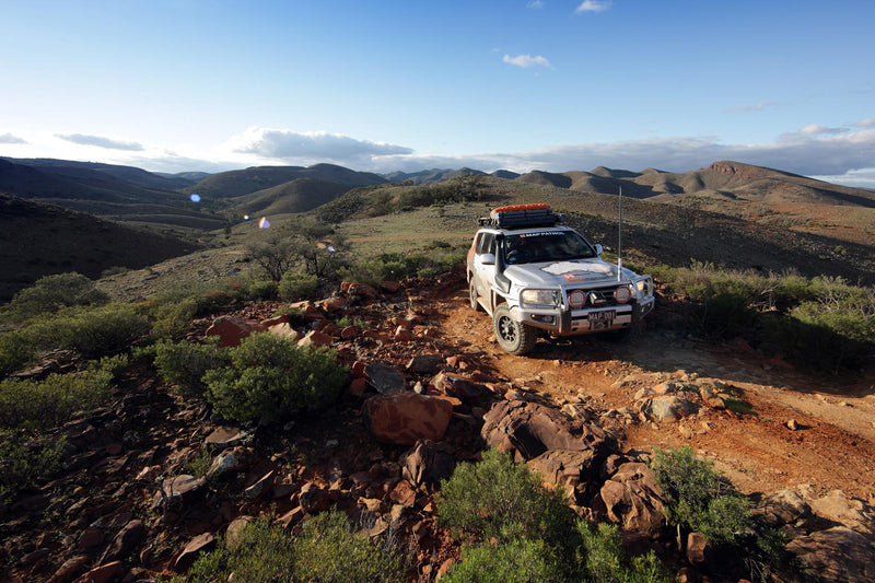
5. Holland Track
The Holland Track traverses 320km from Hyden to Coolgardie, is graded medium and will take two to three days. Spring is the best time to travel to see the wildflowers. Winter rains will make the track impassable, and summer is too hot.

When gold was discovered in Coolgardie in 1892, prospectors came from all around, arriving in boats to Albany and Perth. Prospectors landing in Albany had to find their way to Perth and York before walking to Coolgardie. Many thought that if there was a track from the south to Coolgardie the trip would be much quicker. So, after a few attempts, in 1893 sandalwood collector and kangaroo shooter John Holland, and his team cut a cart track through from Broomehill to Coolgardie. Many gold seekers used the 500km track until the train system was completed three years later. Then the track gradually became overrun by bush.
In 1992, Broomehill farmers Graeme Newbey and Adrian Malloy retraced the trail to create the Holland Track we know today. As 4WD traffic increased the Toyota LandCruiser Club of WA took responsibility for the upkeep of the track. Today, the Holland Track is well signposted and maintained.
Barely out of Hyden lies Western Australia’s iconic Wave Rock. It’s impressive and is a great stop on the way to the trackhead. A short run further along the Hyden-Norseman Road will have you in position at the start of this most popular and interesting section of the Holland Track. A large rock holding the Holland Track Centenary Plaque marks the beginning of your journey.

The iconic Wave Rock
The track itself is generally moderate four-wheel driving, however the twists and turns would make it hard work for towing. Some sections are quite rutted from the rain and those with low clearance may also need to be more careful. While the Track may be littered with many deep mud holes, most of these have an easy side track around them. The Holland Track is known to turn to slippery mud and become impassable after rain, so it’s worth factoring this into your planning.
A trip up Mount Holland is worth the excursion. The drive to the peak is steep, yet relatively straightforward. From the top, it’s possible to absorb the vastness of the area and it’s hard not to have renewed respect for the early explorer, John Holland, and his team.
At the base of Mount Holland are some mining roads. It’s the one area where it’s possible to get navigationally confused, so adhering to the Holland Track signage is particularly helpful at this point.
The rest of the drive northeast is fairly easy to follow. The turn-off to Sandalwood Rocks and its bush camping area is 32km after Mount Holland. At the Banker-Mount Day Road intersection is another plaque commemorating Holland and his exploration.
Diamond Rock, with its bush camp and walking trail, is another interesting stop just to the left of the Track. It’s about another 2km to Thursday Rock where bush camping is also possible.
From the Thursday Rock turn-off, it is 18km to the Victoria Rock Road junction. Head north for 34km from this point to Victoria Rock where the camping area, which features toilets and barbecues, is a popular spot to stop for the night. From Victoria Rock it’s 45km up to the end of your trip at Coolgardie.

Things to Do
Out along the track you’ll immerse into a landscape that is known as the Great Western Woodlands. They are a vast biodiversity region containing over 3000 flowering plants, and are home to threatened mallee fowl, scarlet-chested parrots and red-tailed parrots. With no official conservation status, the area is unfortunately vulnerable. Please stick to maintained tracks and parking areas to avoid damaging the fragile environment.
Maps:
Hema Maps’ Great Desert Tracks West.
Permits and Fees
No permits or fees apply.
Contact Details:
Next steps
At Hema Maps, we strive to provide the most comprehensive and accurate maps and guides for outdoor enthusiasts looking to explore Australia's natural wonders.
Did you find this information useful? If so, please share it with your fellow explorers. Whether it's by sms, social media, or email, your friends and fellow adventurers will appreciate the valuable tips and insights we've shared.
Let's work together to make the most of every adventure.


0 comments