
:
A Guide to Crossing the Simpson Desert in a 4x4
The Simpson Desert is close to the collective hearts of explorers all over Australia, its history and notoriety making it a golden reference on the resumé of any four-wheel driver.
Necessary Information
Sprawled across the borders of South Australia, the Northern Territory and Queensland, the Simpson Desert is closed between December 1 and March 15 each year and is one of Australia's most popular and challenging 4WDing playgrounds. Crossing the Simpson Desert takes a minimum of four days and demands low range and high ground clearance from your vehicle. The best time of the year is May to October, primarily for the purpose of getting far away from the soaring temperatures of a desert summer.
This remote area of Australia provides some epic journeys, but careful planning is needed to ensure you and your 4WD get through safely.
Permits: Camping permits are required for Munga-Thirri (Simpson Desert) National Park, while a Desert Parks Pass is required for entry and camping in the Simpson Desert Conservation Park and Regional Reserve, as well as for camping at Purni Bore in Witjira National Park.
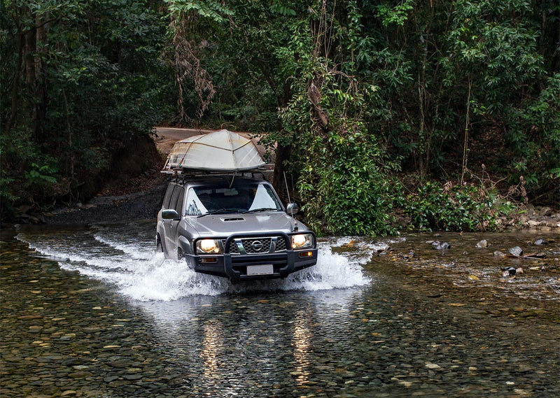
Self-sufficiency: While in the desert, self-sufficiency is essential. Carry at least seven litres of water per person per day, and emergency food and water for another seven days. All emergency supplies (food, water, first-aid kit, sat phone and so on) should be kept in an easily accessible spot. Water is an important way to combat the extreme heat you can experience crossing the Simpson, but remember — temperatures can drop extremely low at night, so pack accordingly.

Fuel consumption: Keep track of your fuel consumption too, taking into account that driving in soft sand increases fuel use by around 50 per cent in diesel vehicles and can almost double it in petrol vehicles. Fuel can be scarce along the tracks, so plan your travel times and distances and top up wherever possible, even if you've still got most of the tank. It's also a good idea to carry a spare jerry can or two for extra fuel or diesel storage.
Desert gear: Desert driving experience is essential, and you should definitely carry traction aids and recovery gear. It's also important to remember that as of March 16, 2014, sand flags are a requirement to drive in the Simpson Desert. Your sand flag must be 300x290mm in size, made of fluorescent materials, and the flag must be 3.5m off the ground.
Communication devices: For communications, scanning UHF CB channel 10 for approaching vehicles is another precautionary rule to abide by for safety going over sand dunes. A UHF radio is a good way of keeping in touch with nearby vehicles, but it is also wise to have a satellite phone and/or a personal locator beacon (such as a ZOLEO or Garmin device) which can be used for general communication and trip updates with friends/family, checking weather conditions and to contact emergency services.
Handy items: Some other handy items to have onboard include a shovel, an axe/saw/chainsaw for cutting wood when wood fires are permitted, a portable tyre pressure gauge and compressor, jump starter, and some cash — some of the stops along the way might not be able to accept cards.
It’s important to remember that tracks are impassable when wet also, and there are fire restrictions in various regions and various times of the year.
Crossing the Simpson Desert
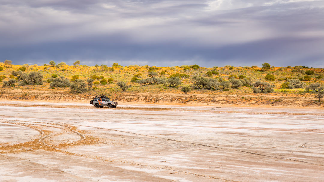
The largest parallel sand dune desert in the world, the Simpson puts 1136 dunes in your path. Crossing it east to west is the most challenging, as the eastern dune faces are generally steeper due to the wind direction. The biggest dunes are on the eastern side of the desert, diminishing in size as a trend to the west. Wherever you choose to enter from, drop your tyre pressure and maintain low speed. This not only makes your own journey easier but does so for those who come after you as well.

As an example, the drive across the French Line and QAA line is the shortest, the most used and the most difficult route, for the simple fact that many of the climbs have been dug out from use. These signs of use are greatly increased when travellers don’t adequately deflate their tyres and drive at consistent speeds, however with some pre-trip desert vehicle preparation these churned sections are negotiable.
Now let's dive into some of the main tracks used when heading on a 4WDing adventure across the Simpson Desert:
French Line & QAA Line
The shortest and most used route across the Simpson Desert can also be the most difficult to traverse due to traffic volume. There are a number of large dunes to cross and many of the climbs become degraded in the course of any given season.

Rig Road
Another major route is the Rig Road, which is the longest and most southern route across the desert and was once the easiest trip before the clay on top of the dunes eroded. The Rig Road was originally built to allow trucks to access the oil exploration area, so it's a better option for larger vehicles; the track also retains a strong feeling of remoteness that can be missing from the French Line in the peak season.

WAA Line
The WAA Line is less trafficked than the French, and also has less corrugations with which to contend. The dunes are also lower, but are often more technical as they can have double dune crests. The WAA leaves the Rig Road where the Colson Track strikes north and heads directly east, crossing the Erabena Track before meeting the Knolls Track. Most travellers then head north to meet the French Line.
K1 Line & Warburton Track
Another option, which is an easy run south between the dunes from Poeppel Corner to the Rig Road-Warburton Track junction, is the track called the K1 Line. The Warburton Track itself is used for access from the Birdsville Track to the Rig Road-K1 Line, though it can be put out of commission when it’s flooded.
Colson Track
This track starts at Numery Station about 120km east of Alice Springs, and ends where it joins the WAA Line, A permit from the Central Land Council is needed to cross the Aboriginal Land.
The Madigan Line
The most remote route across the Simpson Desert is the Madigan Line, which cuts across the north of the desert and follows Cecil Madigan's route from his 1939 expedition. It links the Hay River Track in the east and the Colson Track in the west, with most travellers opting to drive west to east to make driving over windswept dunes easier.

Getting prepared for the Simpson Desert
Being prepared pays dividends in remote areas such as the Simpson Desert, with many fated expeditions in years gone past a stern reminder of that. From Aboriginal explorers through to the early European settlers and up until now, the Simpson has resided in the hearts and minds of lovers of Australia’s red centre; so make your addition to that proud history a memorable and safe one.
Next steps
At Hema Maps, we strive to provide the most comprehensive and accurate maps and guides for outdoor enthusiasts looking to explore Australia's natural wonders.
Did you find this information useful? If so, please share it with your fellow explorers. Whether it's by SMS, social media, or email, your friends and fellow adventurers will appreciate the valuable tips and insights we've shared.
Let's work together to make the most of every adventure.
2 comments


Great article! Lot’s of helpful information.
The Madigan Line is Now only to be Driven West to East Permits must be obtained from Central Lands Council Alice Springs we do 4 tour a year over the Madigan Line and the amount of people doing it from East to West is alarming and Dangerous
can you please put this information in your publication
thank you