
:
Hema's Top 5 Victorian High Country 4x4 Drives
The Victorian High Country is a treasure trove of four-wheel driving adventures, offering challenging tracks, history-filled destinations and scenic views that will take your breath away. Here are five of Hema’s favourites to kickstart your next 4WD road trip.
Please note, the Victorian High Country is an alpine region and many of these 4WD tracks may be subject to seasonal road closures between June and July. So, before you set out on your next 4WD adventure, it's best to check the weather conditions and that no closures are in place.
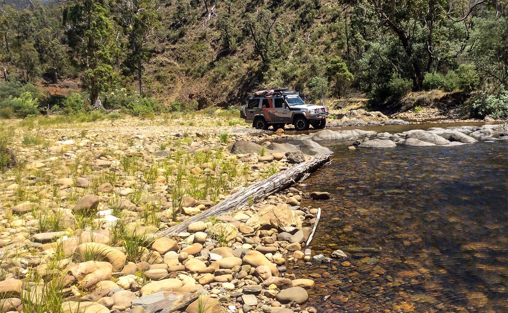
Image: The Hema Map Patrol at the Wonnangatta River crossing along the Blue Rag Range Track
Wonnangatta (Zeka Spur)
This drive stretches 193km from Dargo to Licola and is best spread over two days with a stop at one of many camping areas along the way. It consists of mainly medium grade driving with short difficult sections, requiring high clearance and sometimes low range. From the Dargo pub, drive south down Dargo Road to Shortcut Road and then west onto Crooked River Road to Kingswell Bridge.
From Kingswell Bridge, travel along Wonnangatta Road before turning onto Eaglevale Track, which climbs to Wombat Range Track. Follow Wombat Range Track north to Humffray River, passing the very steep Herne Spur Track. You'll cross the Humffray three times before coming to Wonnangatta River. Along Wonnangatta Track you'll reach the old Wonnangatta Station, home to two of the region's great unsolved murders that took place in 1917 and 1918.
Continuing along Wonnangatta Track, you'll come to Zeka Spur Track, which is a careful 22km amble to meet up with Howitt Road. Turn south on Howitt Road, drive past Howitt Hut and on toward Arbuckle Junction. From the junction, it's an easy 45km south to Licola along Tamboritha Road, passing by the popular camping areas along Wellington River.
Billy Goat Bluff
This spectacular drive travels 132km from Licola to Dargo along some of the most exposed, dramatic tracks in the region. It can be done in a day, though is often split into two by those who wish to take the hike to Lake Tali Karng. There are several steep sections of track and river crossings — high clearance and low range are advised.
Head north from Licola along Tamboritha Road, which turns to gravel as it climbs into the forest, passing the Lost Plain Picnic Area and coming to Arbuckle Junction. Turn east onto Moroka Road and climb to the McFarlane Saddle then descend to Moroka River Crossing, before arriving at Horseyard Flat. Continue along to the Pinnacles Fire Tower.
Billy Goat Bluff Track then starts by heading north on an exposed, narrow, rocky ridgeline. The scramble continues down to Wonnangatta Road, where you'll turn right and drive beyond Kingswell Bridge to Shortcut Road and into Dargo.
The Ingeegoodbee Track is one of the High Country’s 4WD test-pieces. Vehicles require low range, high clearance and sufficient recovery gear, while drivers will need grit and experience for some challenging sections. Clocking in at 110km from Suggan Buggan to Benambra, set aside a day to complete the trek at a casual pace.
The Track begins 7km northeast of Suggan Buggan and proceeds along very steep and scrambly terrain. The initial climb leads to a great viewpoint near Mt Menaak, then proceeds to McFarlane Track. This then rolls along before making a steep descent to the Ingeegoodbee River, which you'll cross 11km after leaving the main road. After the challenging section to McFarlane's Flat you'll cross Berrima River, and then will come to the junction of the Snow Gum Trail. Four-wheelers will then follow Cobberas Trail (walkers can continue beyond the locked gate to Cowombat Flat), crossing Freestone Creek, Suggan Buggan River, and then making a long and difficult climb. Continue along passing several bush camps before reaching The Playgrounds, which is just 4km from the main Limestone Road. From there, it's onto Limestone Road, an easy run to Native Dog Flat and on to Benambra.

Image: The Hema Map Patrol crossing the Ingeegoodbee Track River
Ingeegoodbee Track
The Ingeegoodbee Track is one of the High Countries 4WD test-pieces. Vehicles require low range, high clearance and sufficient recovery gear, while drivers will need grit and experience for some challenging sections. Clocking in at 110km from Suggan Buggan to Benambra, set aside a day to complete the trek at a casual pace.
The Track begins 7km northeast of Suggan Buggan and proceeds along very steep and scrambly terrain. The initial climb leads to a great viewpoint near Mt Menaak, then proceeds to McFarlane Track. This then rolls along before making a steep descent to the Ingeegoodbee River, which you'll cross 11km after leaving the main road. After the challenging section to McFarlane's Flat you'll cross Berrima River, and then will come to the junction of the Snow Gum Trail. Four-wheelers will then follow Cobberas Trail (walkers can continue beyond the locked gate to Cowombat Flat), crossing Freestone Creek, Suggan Buggan River, and then making a long and difficult climb. Continue along passing several bush camps before reaching The Playgrounds, which is just 4km from the main Limestone Road. From there, it's onto Limestone Road, an easy run to Native Dog Flat and on to Benambra.
Mount Pinnibar
This 163km drive from Corryong to Benambra is a full day of four-wheeling. It consists of mostly mid-grade technical driving but will require a high clearance vehicle and possibly a few sections of low-range driving.
Starting at the Corryong Visitor Information Centre, this enjoyable drive starts along beyond the lookout on the edge of town, then heads to Thowgla and Thowgla Upper, along Thowgla Creek. As the bitumen ends, you'll come to Grays Track Recreation Site and continue along Walkers Logging Road. The generally easy climb heads south-east before veering onto the Link Track.
As the route makes a hard turn onto the Pinnibar Track, the real challenges begin. As you climb toward the peak of Mt Pinnibar, the track becomes increasingly difficult until the summit treats you with spectacular views. Descend to the east along Shady Creek Upper Track, dropping toward Shady Creek, climbing out of the creek to meet Cattleman's Creek Track. A short distance later you'll come to Wheelers Creek Logging Road. A sustained yet easy climb leads to Corryong-Omeo Road, which turns south for a good run into Benambra.
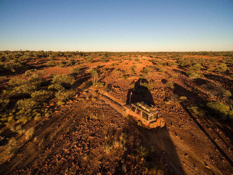
Blue Rag Range Track
This stunning and scenic drive begins in Dargo and ends in Hotham Heights, totalling 113km of driving, if you opt for the diversions. It's not a long day, but allow a day to do it, and be sure your vehicle has high clearance for the rocky, rugged terrain.
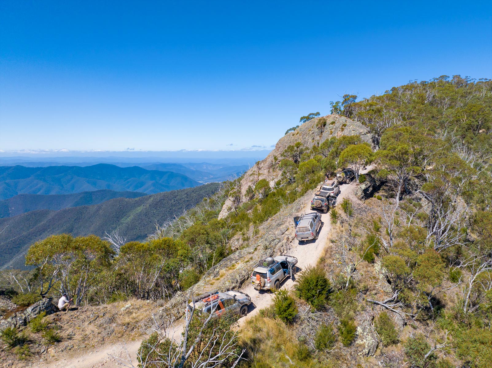
Image: Hema Map Patrol on the Blue Rag Range Track
Begin in Dargo and drive north along Dargo High Plains Road. At 26km and 43km from Dargo, respectively, you can stop at the Treasury-Mt Ewan Huts and Gows Hotel sites to soak in some history.
You'll pass through an area of fenced grazing land before reaching Lankey Plain Hut. From here, you can head east along King Spur Track to Mayford. There are bush camps at the clearing around 11km from Dargo High Plains Road. The old town site of Mayford, a little further on, is a great spot but very little of the town remains to be seen. Back on Dargo High Plains Road, a further 6km finds you at the junction of Blue Rag Range Track. The Blue Rag Range Track becomes steep and rocky, offering dramatic views of the rollercoaster ridgeline that carries the track forward. Continue along the track for 7km to the Blue Rag Trig Point, where you'll find some of the most spectacular views in the High Country.
Back to the Dargo High Plains Road, turn north for an easy 12km drive to the Great Alpine Road, then it's another 12km to the resort of Hotham Heights.
The Hema Map Patrol recently undertook a remapping tour of the Victorian High Country, and had plenty of tips on planning your trip to the High Country and some of the best destinations to check out while you’re there.
Next steps
At Hema Maps, we strive to provide the most comprehensive and accurate maps and guides for outdoor enthusiasts looking to explore Australia's natural wonders.
Did you find this information useful? If so, please share it with your fellow explorers. Whether it's by sms, social media, or email, your friends and fellow adventurers will appreciate the valuable tips and insights we've shared.
Let's work together to make the most of every adventure.
2 comments


So this is only for 4wd no camper etc . Please can you tell us only single 4wd or suitable 4wd plus camper plus off road small hybrid caravan . Thanks
try ‘lost spur track’ after weeks of rain. it took us 12hr to get our 3 car convoy up. queens birthday 2022