
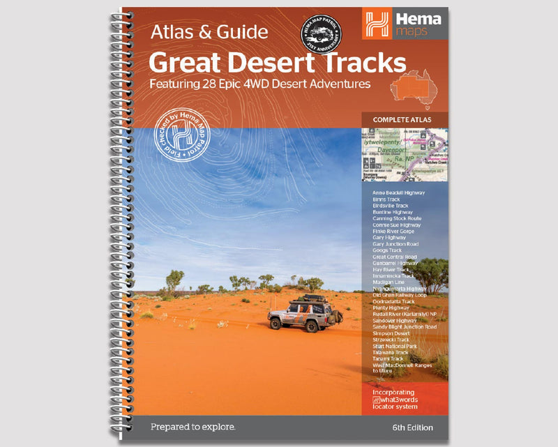
:
Road Closures & Track Conditions 3rd June 2022
Australia
Border Update -
Open to International Visitors |
|
For more information refer to: https://www.health.gov.au/news/health-alerts/novel-coronavirus-2019-ncov-health-alert/coronavirus-covid-19-restrictions/coronavirus-covid-19-advice-for-international-travellers
La Nina -
The Bureau of Meteorology announced the beginning of a La Niña on the 24th November 2021, which most likely means a wet summer period for eastern and northern regions.
La Niña is a recurring event in our weather cycle, not to be confused with the warmer El Niño, that operates over periods of one to eight years. It manifests when strong equatorial trade winds change ocean currents, drawing cool water up to the surface in parts of the Pacific Ocean, resulting in a pile up of warm surface water east of Australia. This leads to a boost in convection that has a pronounced effect on the global climate.
Every La Niña event is different, but according to the BOM this time Australia is likely to see:
More rainfall in Eastern, Central, and Northern Australia
Decreased daytime temperatures south of the tropics
More tropical cyclones
Increased chance of widespread flooding
Longer, less intense heat waves in south east of Australia
Earlier First Rains across Northern Australia
Less risk of fires in areas that receive more rainfall
Northern Territory
Border Update -
Interstate Restrictions |
|
Internal Travel Restrictions |
|
For more information refer to: https://coronavirus.nt.gov.au/travel/quarantine
Regional Update -
The cloud band in the south is weakening but a trough extending into the NT from WA will maintain a risk of showers and thunderstorms across southern and central districts until the weekend. Remaining humid over the Top End. A new ridge will build into the Territory from early next week sending a cooler and drier south easterly surge northwards into the Top End later in the week.
‘The Dry’ season has concluded, with La Niña conditions expected. The weather is looking wetter than average over the next couple of months.
Gibbie Creek 4WD Track - Road Closed - Between Fish Hole yard wickham 4wd track and Gregory National park boundary. (Last updated: 26/05/22).
Flooding has resulted due to significant rainfall in the last few weeks. Some tracks in Northern NT are closed or impassable.
Western Australia
Border Update -
Interstate Restrictions |
(Last Update: 03/06/22). |
Internal Travel Restrictions |
|
For more information refer to: https://www.wa.gov.au/organisation/department-of-the-premier-and-cabinet/covid-19-coronavirus-travel-wa
Regional Update -
-
Kimberley:
A trough will linger over the Kimberley through to early next week. A new cloud band is expected to develop over northwest WA early on the weekend.
-
Fire Risk:
North Kimberley Coast: Low-Moderate
West Kimberley Coast: Low-Moderate
Kimberley Inland: Low-Moderate
Warm-Hot temps (Low 30s) expected.
Road Alert - Gibb River Rd - Seal 15 km in 5km sections between El Questro turnoff and Pentecost River. Stop/slow traffic management in place with speed restrictions. Delays of less than 5 minutes may be experienced. (Updated: 26/05/22).
-
Pilbara:
A trough will linger over the Kimberley through to early next week. A new cloud band is expected to develop over northwest WA early on the weekend.
-
Fire Risk:
East Pilbara Coast: Low-Moderate
West Pilbara Coast: Low-Moderate
East Pilbara Inland: Low-Moderate
Ashburton Inland: Low-Moderate
Exmouth Gulf Coast: Low-Moderate
Partly cloudy. Winds east to southeasterly throughout the week, temps top of 27c
Road closed - Nanutarra Munjina Rd both directions between Manuwarra Red Dog Hwy (Bingarn Rd) and Hamersley Rd - Flooding (Updated: 26/05/22).
-
South West WA:
A weak cold front will brush past the south coast on Friday before a firm ridge of high pressure arrives on the weekend over the South West Land Division.
-
Fire Risk:
Geographe: Low-Moderate
Leeuwin: Low-Moderate
Nelson: Low-Moderate
Partly cloudy. Medium (40%) chance of showers in the south. Temps into the high teens.
Quite extensive road works are being undertaken on the South Coast Highway.
Muir Hwy btwn Manjimup and Rocky Gully - Upgrades. Lane closures under traffic lights EXPECT SIGNIFICANT DELAYS. (Updated: 26/05/22).
South Australia
Border Update -
Interstate Restrictions |
|
Internal Travel Restrictions |
|
For more information refer to: https://www.covid-19.sa.gov.au/restrictions-and-responsibilities/travel-restrictions
La Niña -
More rainfall during spring and summer, wetter soils and an increased chance of flash floods. Reduced bushfire risk with reduced extreme heat waves. More rainfall expected in the north/central areas of South Australia.
Regional Update -
A high pressure system centred over the east coast of NSW will move eastwards during Friday. A series of troughs and cold fronts will move across the south of South Australia over the next few days then a high pressure ridge will move across from the west mid to late next week.
Rain Closure openings: Large amounts of outback SA roads have recently closed after poor weather - some have reopened with heavy restrictions. (updated: 03/06/22).
Birdsville inside Track Closed - Lengthy closure still in place, Mungeranie to Marree (updated: 03/06/22).
Oodnadatta to Marla and Oodnadatta to Coober Pedy routes Closed (updated:03/06/22).
Road Works: Road Sealing - Strzelecki Track (472km). The SA government has sealed the first 50-kilometres, Starting just north of Lyndhurst.
Victoria
Border Update -
Interstate Restrictions |
|
Internal Travel Restrictions |
|
For more information refer to: https://www.dhhs.vic.gov.au/victorias-restriction-levels-covid-19
La Niña -
More rainfall during spring and summer, wetter soils and an increased chance of flash floods. Reduced bushfire risk with reduced extreme heat waves.
Regional Update -
A cold front approaches from the west during today with moderate northerly winds across the state, freshening about the west in the afternoon. This front will cross Victoria on Saturday, with a second cold front expected to cross on Sunday bringing gusty northwesterly winds as a deep low moves to the southwest of the State. This low will slowly move to the east of Tasmania on Monday, extending a cold west to southwesterly stream over Victoria.
Haunted Stream Track: Haunted Stream Track - Tambo Crossing is closed. DELWP are undertaking repairs. Reopening will be dependent on weather conditions.
High Country: Seasonally Closed tracks are mostly open with the majority of seasonal road closures for 2022 beginning on 16 June. Check the list of tracks open/closed.
Tasmania
Border Update -
Interstate Restrictions |
|
No Internal Travel Restrictions |
|
For more information refer to: https://coronavirus.tas.gov.au/travellers-and-visitors/coming-to-tasmania
La Niña -
More rainfall during spring and summer, wetter soils and an increased chance of flash floods. Reduced bushfire risk with reduced extreme heat waves.
Regional Update -
A ridge of high pressure to the east of Tasmania directs a northwesterly stream which will freshen today ahead of a cold front crossing later in the evening. A northwesterly flow will return on Saturday as a complex low approaches from the west, causing winds to strengthen on Sunday as the lows near the west coast in the evening. The lows are expected to cross Tasmania early Monday, heralding a colder and strong southwesterly change.
Drive With Caution Warning: Cradle Mountain Road and Belvoir Road – Reports of heavy snow in the area, motorists to consider necessity to travel, use extreme caution, reduce speed and drive to the conditions.
New South Wales/ ACT
Border Update -
Interstate Restrictions |
|
Internal Travel Restrictions |
|
For more information refer to: https://www.nsw.gov.au/covid-19/what-you-can-and-cant-do-under-rules/border-restrictions
La Niña -
More rainfall during spring and summer, wetter soils and an increased chance of flash floods. Reduced bushfire risk with reduced extreme heat waves. More rainfall is expected in most of New South Wales.
Regional Update -
A high pressure system lies over the Tasman Sea, while a trough will move into the northern inland today. On the weekend and early next week a series of troughs and cold fronts will cross southeastern Australia, bringing a return to cold and blustery conditions to much of the state.
Flooding - Closures in the North West of the state. North of Broken Hill and West of Wanaaring. Some tracks have reopened. Never drive through floodwater (Updated 03/06/22).
Queensland
Border Update -
Interstate Restrictions |
|
Internal Travel Restrictions |
|
For more information refer to: https://www.qld.gov.au/health/conditions/health-alerts/coronavirus-covid-19/current-status/public-health-directions/border-restrictions
La Niña -
More tropical Cyclones than normal. Prepare earlier - Rain expected a month earlier, more than 70% chance of above-average rainfall and increased flood risk.
Regional Update -
A high over the Tasman sea extends a ridge over Queensland. A trough will move eastward across the state today, clearing offshore of the Southeast Coast during Saturday. Another trough may move across southeast Queensland during Monday, before a high moving into the Great Australian Bight extends a strengthening ridge and a cool, dry airmass across the state through the early days of next week.
Cape York: Peninsula Developmental Road - Road Works - at Archer River Road.
-
Fraser Island:
Areas of concern - Most of the West coast is closed to beach driving.
Look and listen for aircraft landing and taking off along the eastern beach. Follow direction from the ground control crew.
Wongari (Dingo) warnings – Be dingo-safe!
Fraser Island report - 24th May, 2022.
Hazard: Adverse driving conditions - Recent rain has resulted in major closures with Long-term flooding throughout central QLD. With roads closed in both directions. Do not drive in flood waters.


0 comments