
:
Hema Maps launches new edition of its Western Australia Road & 4WD Track Atlas
Hema Maps, Australia’s leading publisher of trusted and verified maps, is excited to announce the release of its latest product: the 4th Edition of its bestselling Western Australia Road & 4WD Track Atlas.
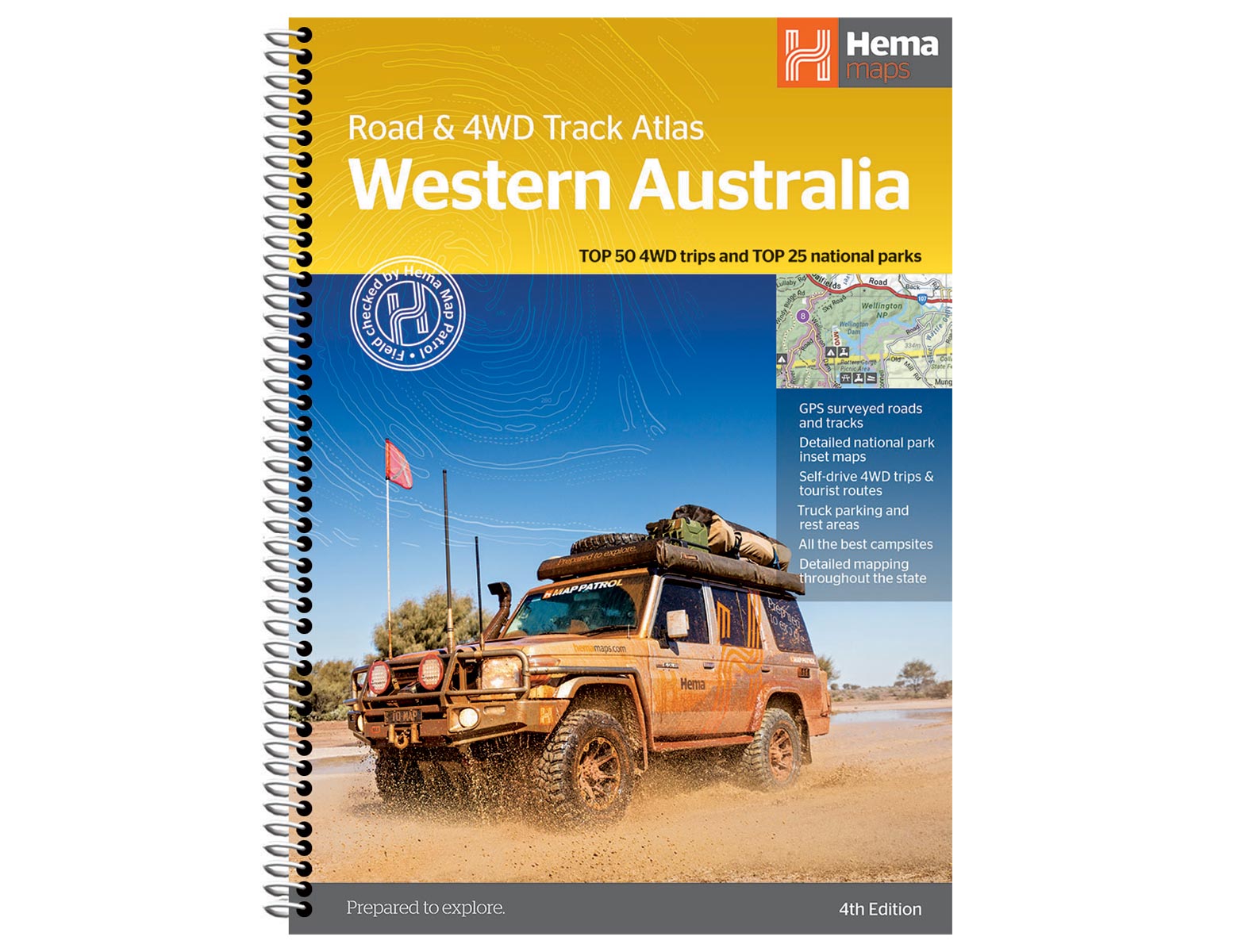
This new edition is an indispensable companion for anyone embarking on a grand expedition of our country’s largest state. The new Western Australia Road & 4WD Track Atlas features the Top 50 4WD trips, each accompanied by track grading, distances, contact information and an atlas reference.
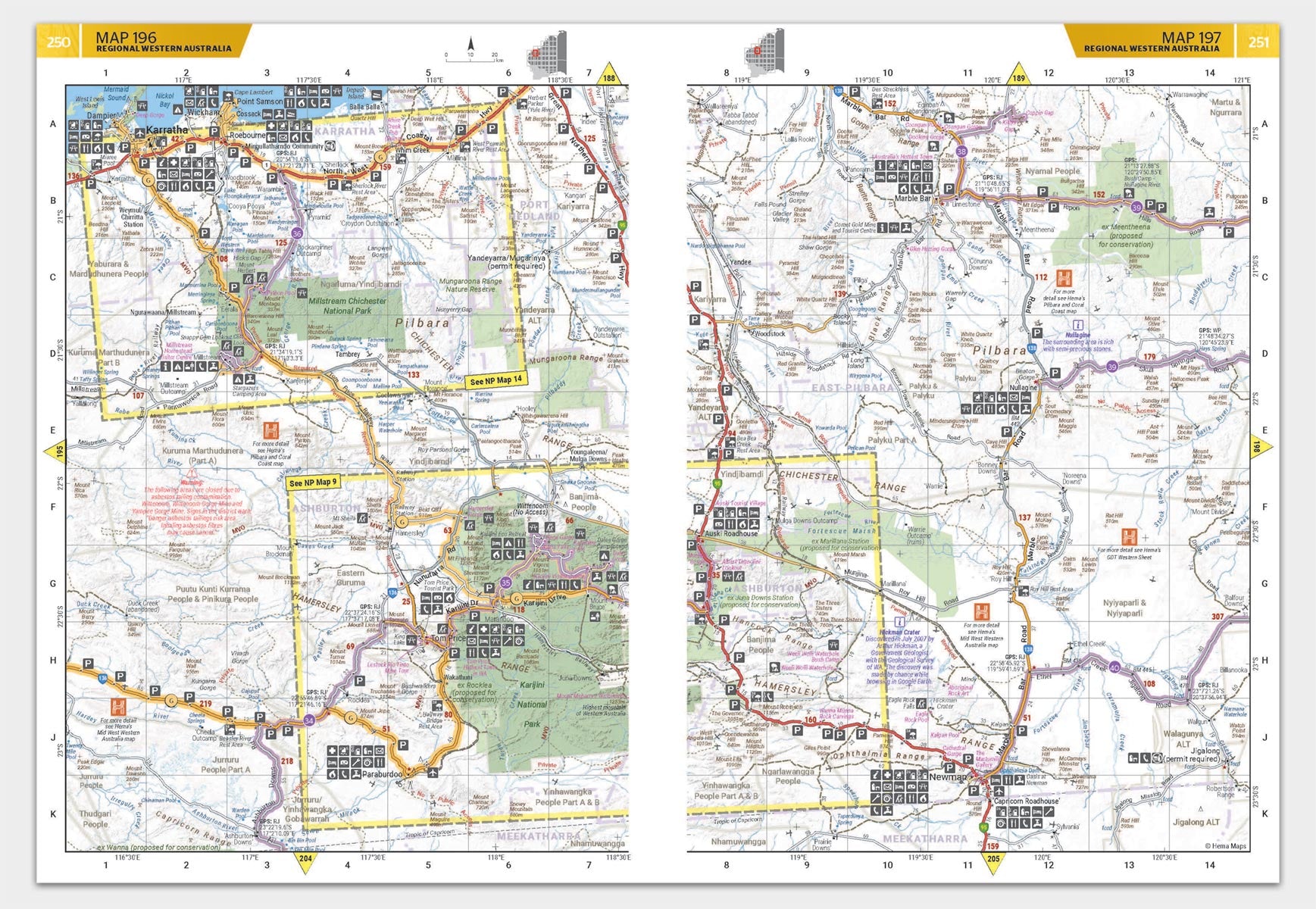
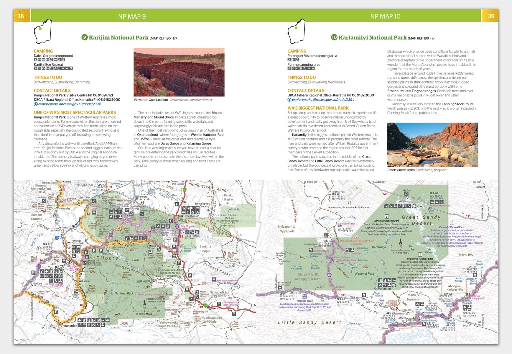
The tracks within this new road and 4WD track atlas are coded by vehicle type with suitability symbols and relevant information including permit requirements and contact details. Track profiles show elevations and distances as well as points of interest (POI), camping areas and supply points.
This atlas goes beyond the beaten track, offering insights into private camping areas and caravan parks, ensuring you have a range of accommodation options. An index and a list of accredited visitor centres within Western Australia add to the practicality of this guide.
This 312-page atlas is packed with more detail than ever before with 177 pages of detailed road and track maps (1:250,000 scale) for the entire southwest region (Geraldton–Margaret River to Kalgoorlie and Esperance), 50 x 1:1,200,000 regional road maps, plus 50 detailed national park maps all of which have been extensively field-checked by Hema’s Map Patrol and Alpha Teams.
On the release of this new edition, Hema Maps General Manager of Product Rob Boegheim commented, “The WA Road & 4WD Track Atlas continues to be the most comprehensive, detailed and up-to-date atlas of WA that just gets better and better with each new edition. There is just so much to discover and explore in this massive and beautiful state, but you need the best maps to explore with confidence and come home safely.”
The 4th Edition of the Western Australia Road & 4WD Track Atlas ($44.95) is now available for purchase on the Hema Maps website and at leading retail stores.
About Hema Maps:
Founded in 1983, Hema Maps has built a reputation as masterful map makers in the four-wheel driving and outdoor adventure industries. With a keen focus on offroad touring, Hema has mapped more than 690,000km of tracks and 545,000km of unsealed roads throughout Australia since 1996.
Next steps
At Hema Maps, we strive to provide the most comprehensive and accurate maps and guides for outdoor enthusiasts looking to explore Australia's natural wonders.
Did you find this information useful? If so, please share it with your fellow explorers. Whether it's by sms, social media, or email, your friends and fellow adventurers will appreciate the valuable tips and insights we've shared.


0 comments